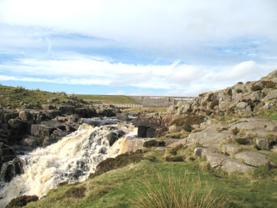
CAULDRON SNOUT

"At the bottom there is time to stand and take in a marvellous panorama, an amphitheatre of sheer wonder, the living heart of Upper Teesdale complete with pulsing water. Behind to the north, tower the rock bastions of Falcon Clints. As the name suggests, golden eagles used to wheel over these great cliffs. Perhaps one day they will be back to enjoy lost eyries, still full of fern and heather. Cowberry and crowberry cling to the cliffs with the odd gnarled mountain ash hinting of the forest that once did its best to cover the whole terrain."
England's Last Wilderness. A journey Through the North Pennines. David Bellamy and Brendan Quayle. 1989
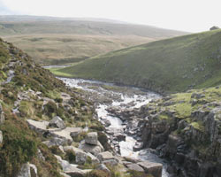
The Tees soon begins to curve south upstream from Cronkley Bridge, passing the high cliffs of Cronkley Scar and Falcon Clints. Cauldron Snout lies just above that part of the river, a series of waterfalls over 400 yards (366 metres) long. They are England's biggest cataract, 8 falls where the Tees drops 220 feet (60 metres) as it cascades over the Whin Sill. Spray rises as the water hits the rocks and from the top the Tees can be seen below, relapsing into the tranquil mode it displayed before plunging over the falls. At their foot Maize Beck adds its waters to the Tees.
Before the reservoir at Cow Green was constructed to regulate the flow of water, Cauldron Snout and High Force were more violent and powerful than they are today. Nevertheless, the sight and sound of this large volume of water thundering over the rocks is still impressive. It is possible to clamber down the rocks beside the falls where a path, actually the Pennine Way, leads to Langdon Beck on the main B6277 road. Another branch of the footpath goes east to Middleton. Cauldron Snout is a very appropriate name for such a natural phenomenon.
- Constructed - not applicable.
- Type - not applicable.
- Position: near Bowlees, County Durham.
- Grid Ref: NY 889 283

