BLYTH TO STANNINGTON

"Blyth has no pretensions to be other than a workaday port, though its waterfront is not without interest to those who love ships."
The Companion Guide to Northumbria. Edward Grierson. 1976
The port of Blyth is situated at the river mouth and is the biggest setlement on the River Blyth. On the north side are North Blyth on a narrow spit of land and Cambois, both like Blyth itself associated with coal and shipping. Near the river mouth the Sleek Burn flows into the Blyth on its north side. At the heart of the once important Northumberland coalfield the town of Bedlington lies about 3 miles up river, which turns south at that point following which the river becomes largely rural for the remainder of its length.
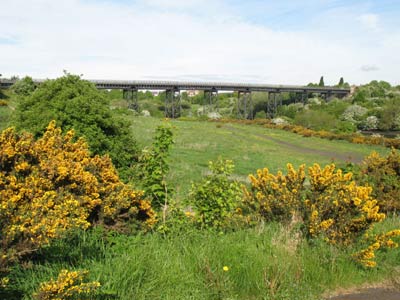
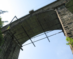
There are several major bridges on this section including the only two railway crossings of the river. Upstream is Plessey Woods Country Park which lies near the Hartford Bridge and is a popular leisure area for walkers, horse riders, cyclists and others in its 100 acres of woodland. The east coast main line crosses the river on an impressive viaduct just upstream, and at the village of Stannington the A1 trunk road crosses the Blyth.
- Kitty Brewster Bridges - 1960 and 1996.
- Bedlington Railway Bridge - 1930.
- Furnace Bridge - not known.
- Bedlington Bridge - 1928, modified 1996.
- East Hartford Stepping Stones - not known.
- Hartford Bridge - 16c, modified 1904.
- Plessey Railway Viaduct - 1850.
- Stannington A1 Bridges - 1932 and 1937.

