Bridges On The Tyne
MAPS OF THE RIVER TYNE

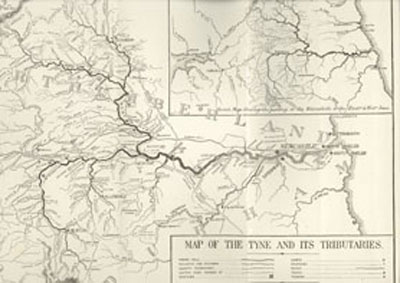
Maps showing the River Tyne generally also include roads and other features so that the river and its bridges do not show up prominently. The maps pictured here show only the rivers and give a clearer indication of how the Tyne divides into its North and South arms and also show the many tributaries which add their waters to the main river.
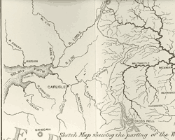
The smaller map inset shows the watersheds whereby the eastern rivers flow right towards the North Sea and the western rivers left towards the Solway Firth and hence into the Irish Sea.
Main Tributaries of the Tyne
- The list shows the main tributaries and where they flow into the Tyne
- Main Tyne
- River Don - Jarrow
- Ouseburn - Newcastle
- River Team - Dunston
- River Derwent - Derwenthaugh/Swalwell
- Devil's Water - Dilston
South Tyne
- River Allen - near Ridley
- River Nent - Alston
North Tyne
- River Rede - Redesmouth
- Kielder Burn - Kielder
- Deadwater Burn - Deadwater
Watershed of rivers, including Tyne

The map shows the parting of the watersheds towards the East and West Seas. The Rivers Liddel, Line and Eden are to the west, while the Tyne, Wear and Tees flow to the east.

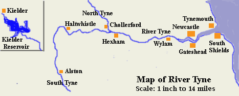
This map shows the River Tyne with towns and villages indicated. The upper section of the North Tyne is shown on the continuation map inset.
© Bridges On The Tyne 2006

